Triaxes StereoTracer is designed for rendering multi-view images out of one original photo and depth-map in order to create 3D-image (stereo or flip). StereoTracer can either use given depth-map or create depth-map "on-the-fly" out of original photo.
Map Export is a GIS developer oriented tool for downloading and exporting background image. Map Export can export both satellite imagery and street maps from Google Map. It can export in many kinds of bmp format as you like.
Easily create HTML image maps with this friendly photo and image map editor. Pos HTML Image Mapper includes WYSIWYG interface allowing you mapping images fast and easy.
There are very easy to customize via XML. You don't need to know Flash. The maps are 100% vectorial graphic. Get 20 maps at the price of 6. This package contains: XML Canada Map, XML USA Map, XML Central America, XML South America, XML Europe Map, XM
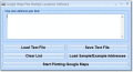
a tool to make region map with self-definition color. The original maps in the software are blank political region ones for different countries or areas. You can color any region with whatever color as you like.
Map View is a professional map browser. Both satellite imagery and maps online can be viewed through it. With the cache technology, it improve the user experience of viewing map.
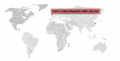
An elegant interactive flash map of the world. This interactive world map includes 165 clickable countries. Display country statistics, country-specific information or mark pinpoint locations. The map uses XML and is easy to customize or install.